GEOSPATIAL DATA
GIS Vector Data
East View Geospatial produces a wide variety of GIS-ready data to provide best in class GIS vector data to government, private, and non-profit organizations.
Plug and Play Datasets for All GIS Professionals
East View offers all types and formats of digital mapping and geospatial data. Worldwide off-the-shelf GIS-ready geospatial data is available for immediate delivery and new digital content is continuously being created based on the most authoritative sources. Our team of experienced professionals adds value to GIS-ready data to deliver feature data extraction, file format conversion, data conflation, metadata collection and enhancements. From building databases and transportation networks to GIS census data and points of interest (POI), we can enhance your GIS process with datasets suited to your needs.
A World of GIS Vector Data
Here is a sampling of the vector datasets we offer.
Looking for something else? Contact Us or check out our custom GIS vector data extraction services.
Need help optimizing your own vector data? Contact Us to discuss format conversion and other options for your data.
Spotlight On
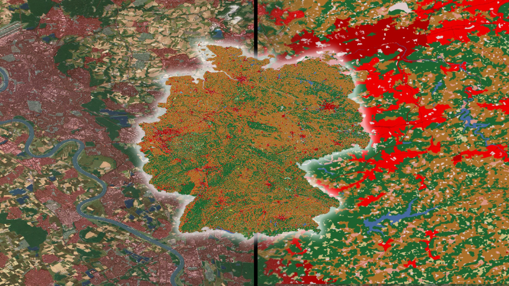
Germany Land Use/Land Cover Data
Our brand-new, nationwide land use/land cover data over Germany is the perfect environment for analysis of urban planning, environmental monitoring, and agriculture management. We have paired our data with PlanetObserver’s seamless imagery, creating a complete plug-and-play environment for geospatial analysis. Get immediate, and clear, actionable insights in your GIS platforms.
From township to global coverage, East View provides dense, gap free, authoritative vector datasets that meet your project requirements.
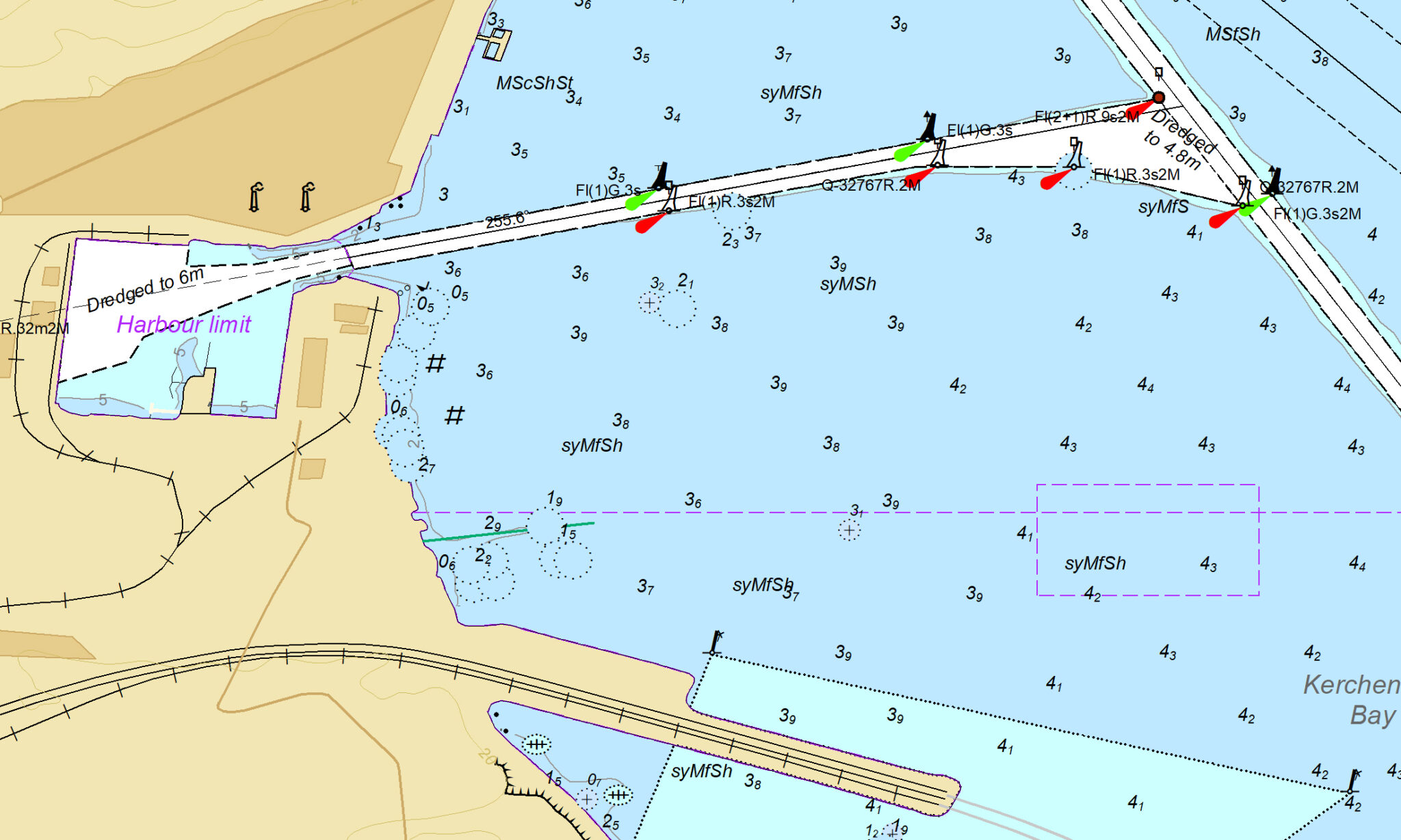
We offer a wide variety of maritime data including electronic navigational chart (ENC) vector data, S-57 data, global nautical datasets, vectorized raster nautical charts, bathymetry data, and automatic identification system (AIS) data.
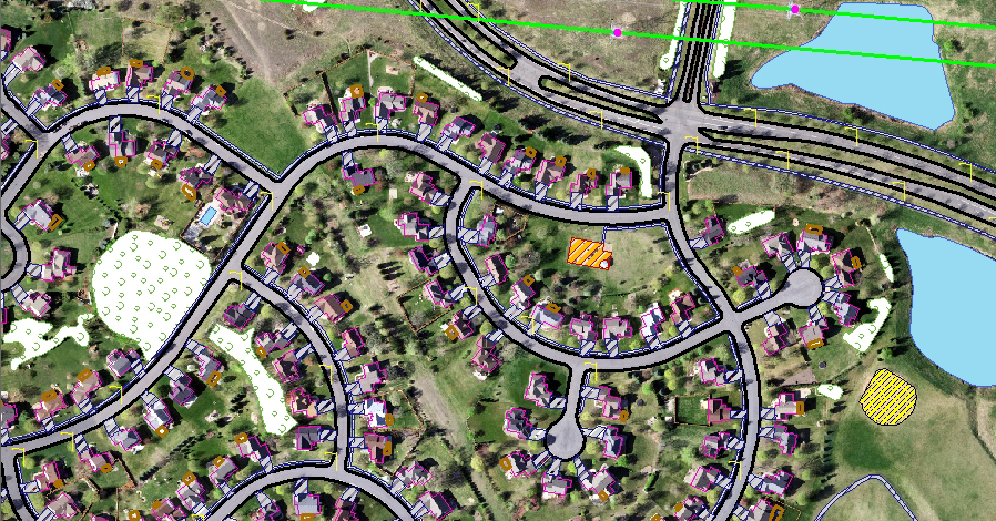
Municipal Vector Data Packages
Cost-effective solutions for updating and maintaining state or county planimetric feature data, delivered in any GIS format. Includes features like roads, railways, buildings, power lines, streetlights, fences, culverts, wooded areas, lakes and rivers.
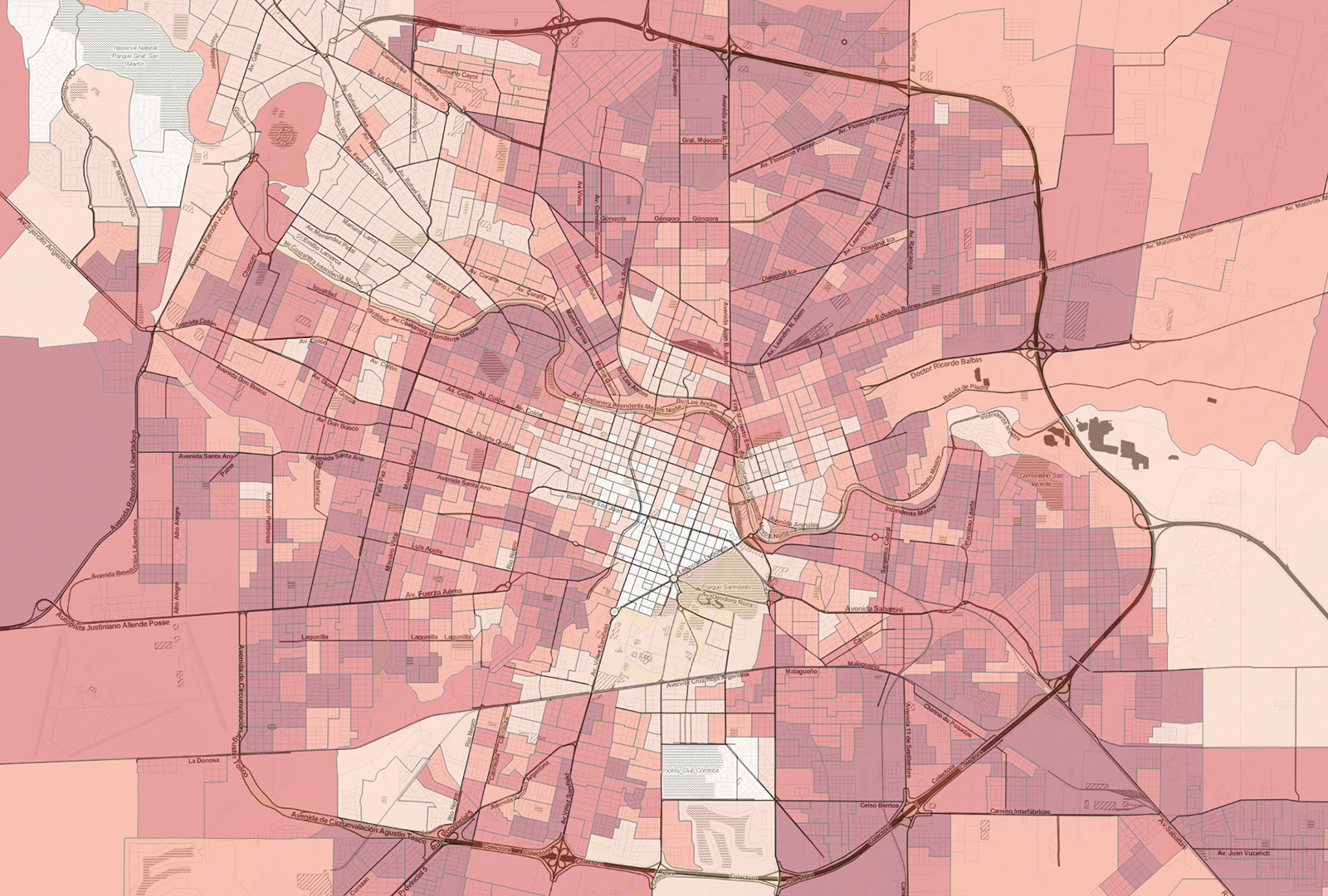
National census authorities around the world have increasingly made census outputs available as GIS-formatted data. East View acquires the official data outputs and employs a workflow to ensure a uniform format for these materials that can be used by several GIS platforms.
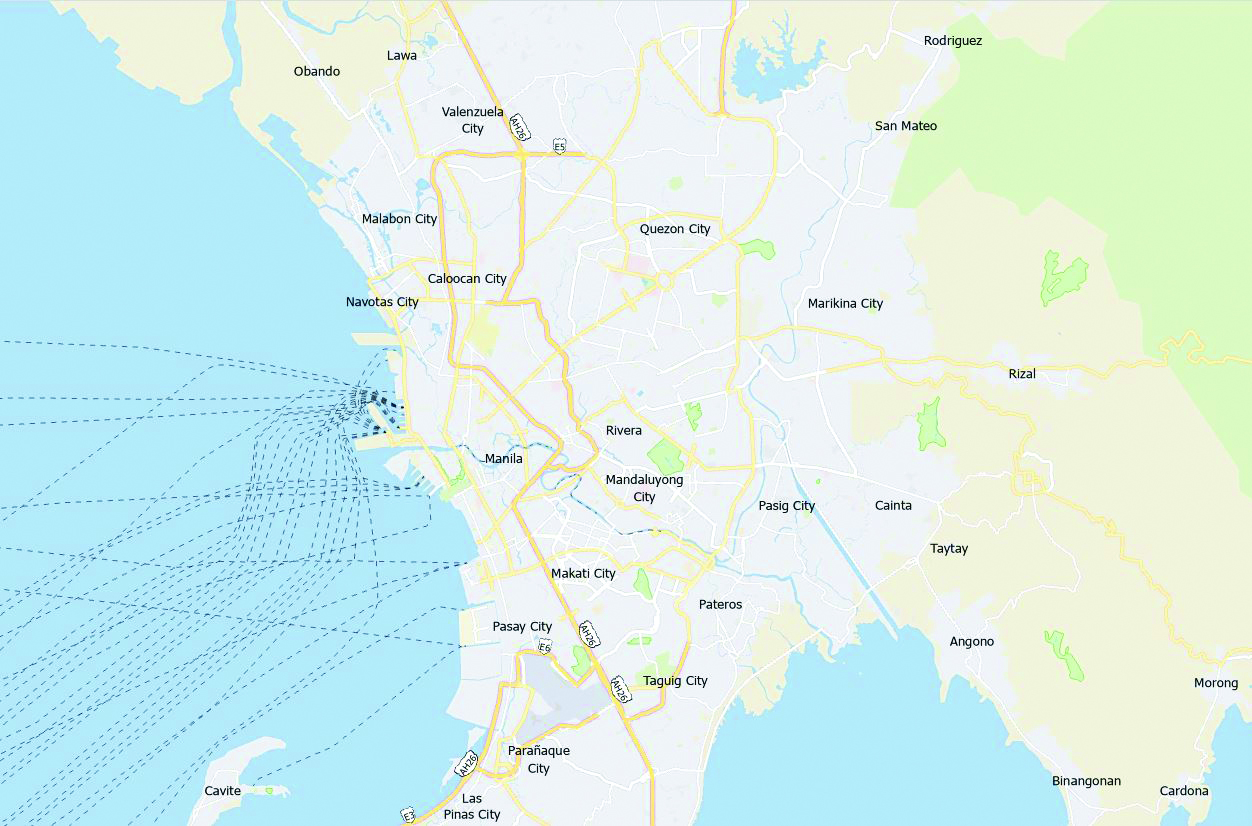
As official partners of TomTom and HERE Technologies, we offer full navigation vector datasets, including transportation network, traffic, point of interest (POI), and automatic identification system (AIS) data, and geocoding databases.
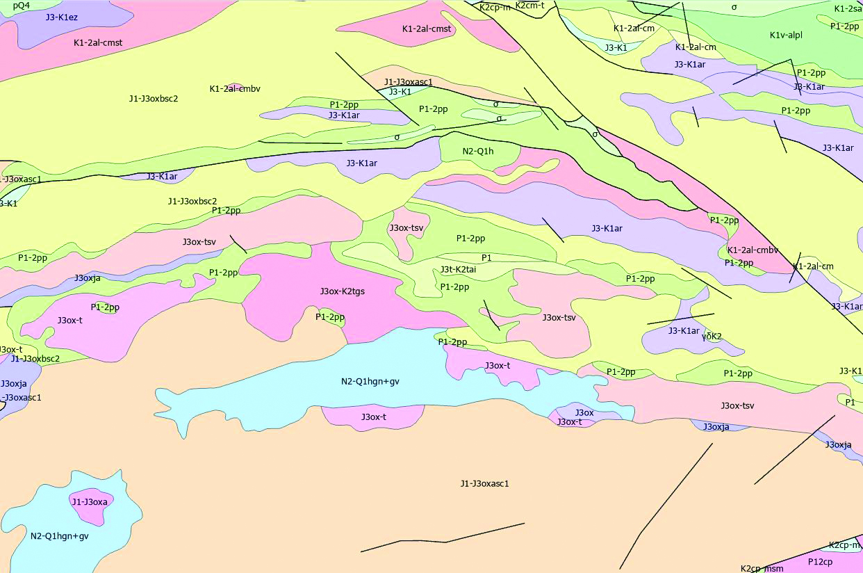
A collection of information about the planet’s rock formations, faults and folds, and minerals suitable for applications such as mining and mineral exploration, environmental monitoring, and engineering. A variety of attribution is available for geological features, including type, age, composition, and characteristics.
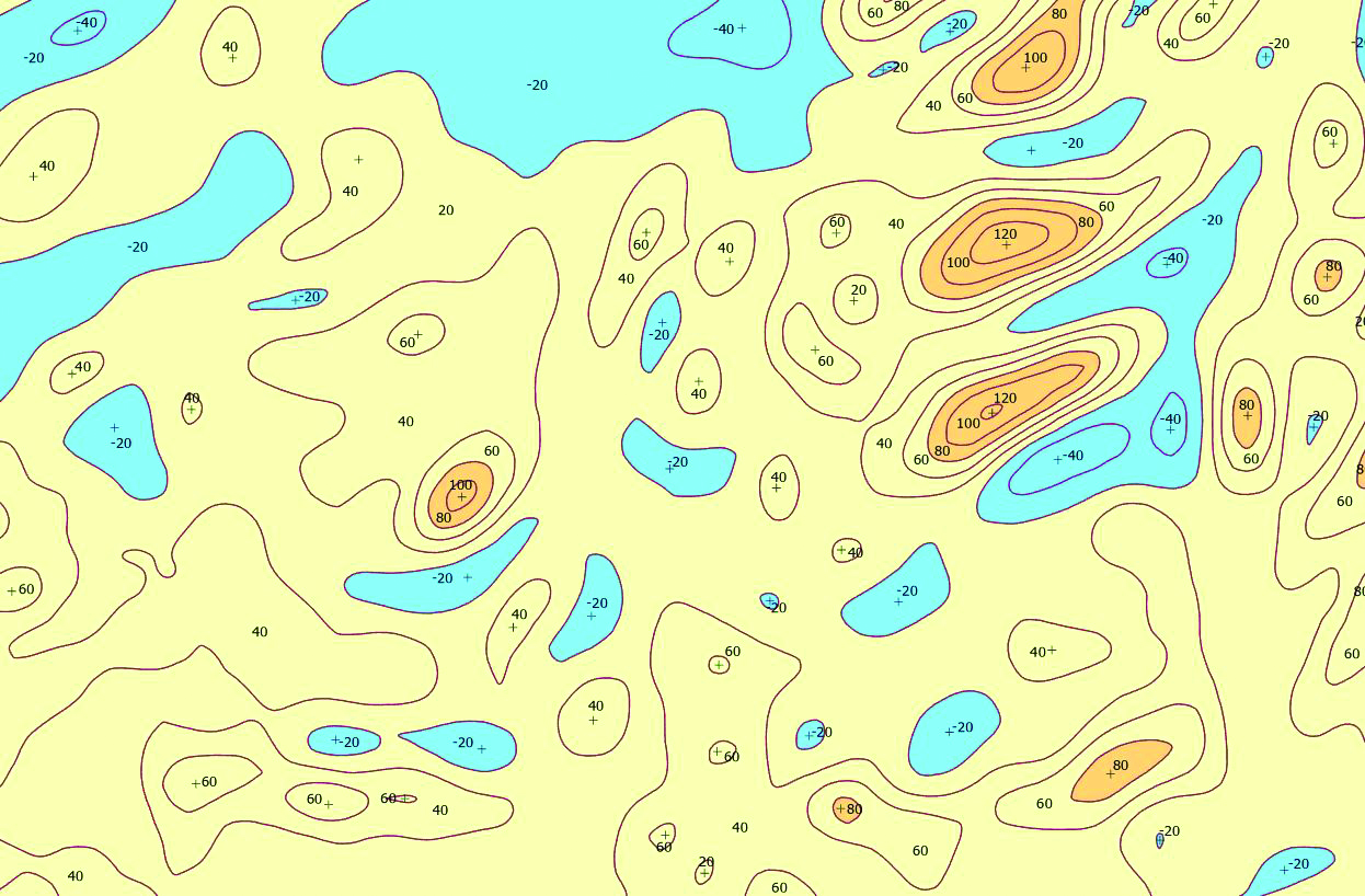
Gravity
Gravity vector data is a visual representation of the variations in the strength of gravity across a specific area or the entire Earth. Typically extracted as a series of points, lines, and polygons, it also includes values indicating anomalies in the gravity field.
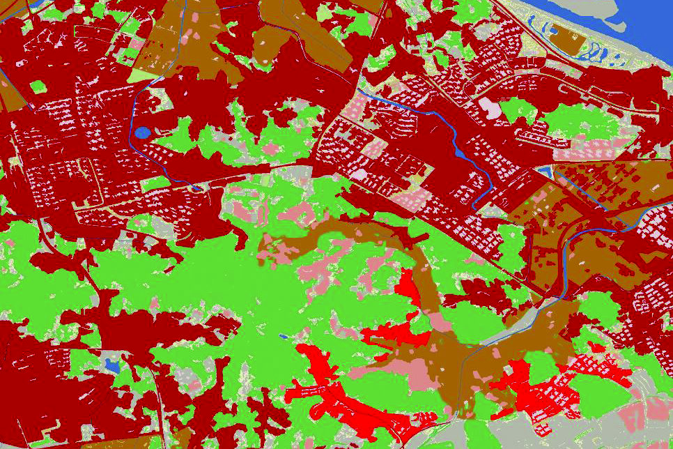
Land Use & Land Cover
We regularly produce detailed land use and land cover data to gain a better understanding of how land is being used, along with an accurate means of monitoring change over time.
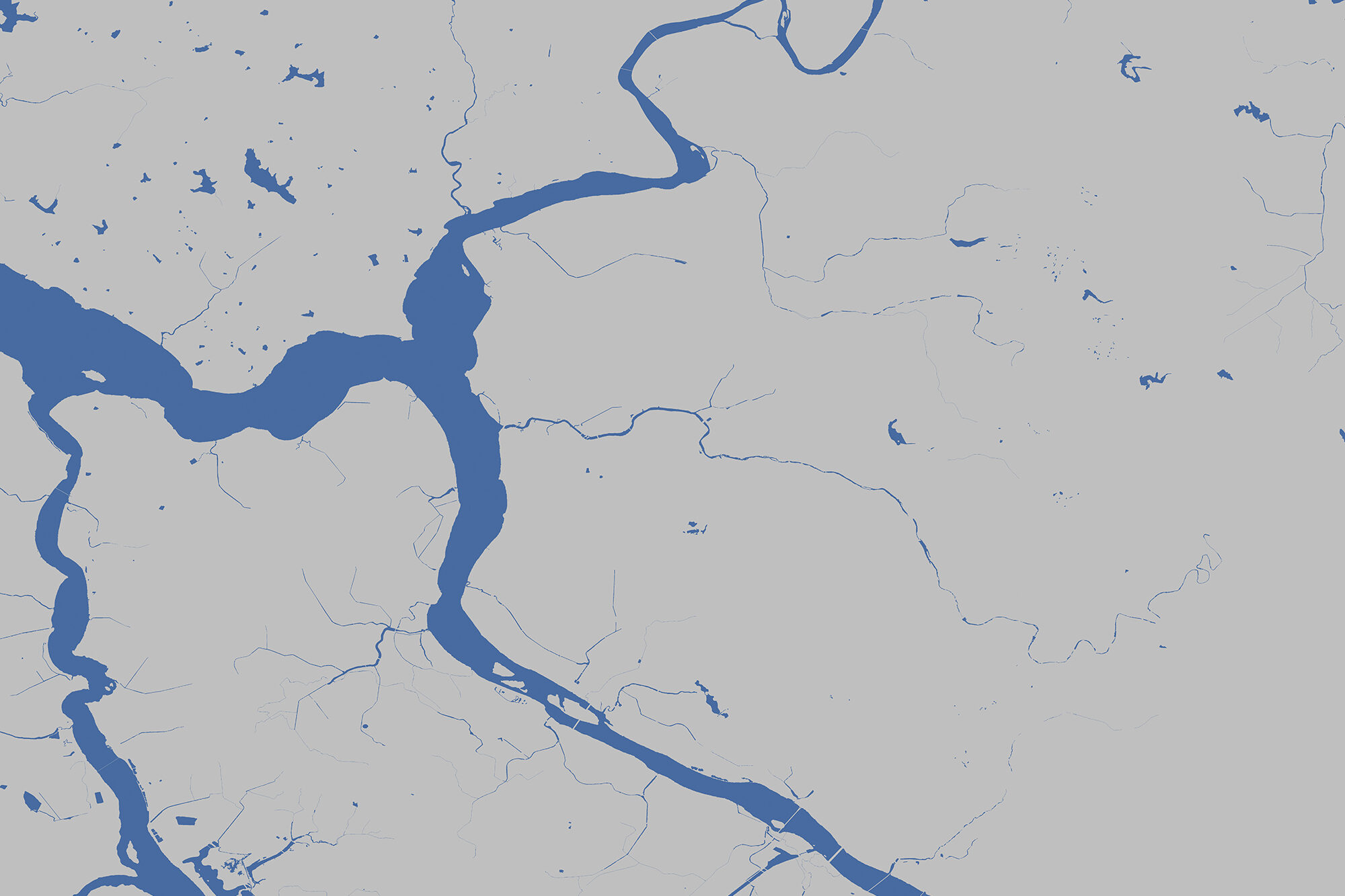
Water Mask
Water mask vector data provides polygonal coverage of rivers, lakes, oceans, and other waterbodies. This data is useful for defining and visualizing the boundaries between land and water. Its precision and detail make it a valuable asset in many applications.
Looking for something else? Check out our custom GIS vector data extraction services.