
Discover Thousands of Geospatial Resources With Global Explorer
Global ExplorerTM is East View Geospatial’s exclusive e-commerce experience. Users can browse our extensive catalog of data, purchase off-the-shelf and made-to-order data, and inquire about procurement and custom production options.
Start your search on geospatial.com to access in-depth information by country, or use the text, category, or map search options in Global Explorer to discover data. Find information on each method by using the links to the left or head over to Global Explorer to start browsing our geospatial resources.
Searching by Map in Global Explorer
The map search allows users to select an Area of Interest to discover the various maps, charts, terrain and digital elevation models available over the area. Users can toggle between this view and the category view by selecting the icon at the lower left corner of the interface.
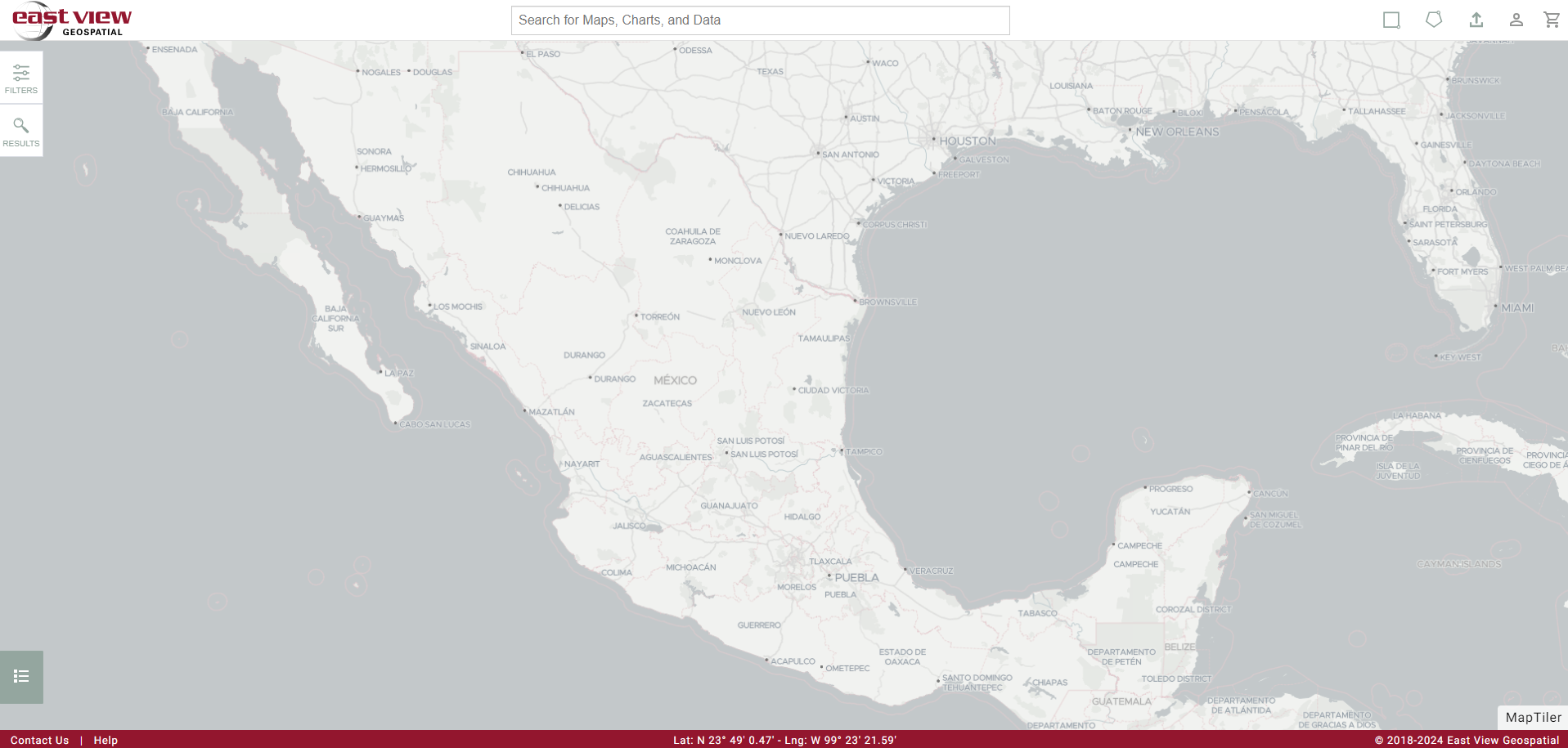
Selections can be made on the basemap with the drawing tools in the upper right corner, or start your search by accessing the filter drawer located on the upper left corner of the interface. Drawing a polygon will deliver immediate search results that can then be refined using the filter drawer. Results and filters can be toggled.
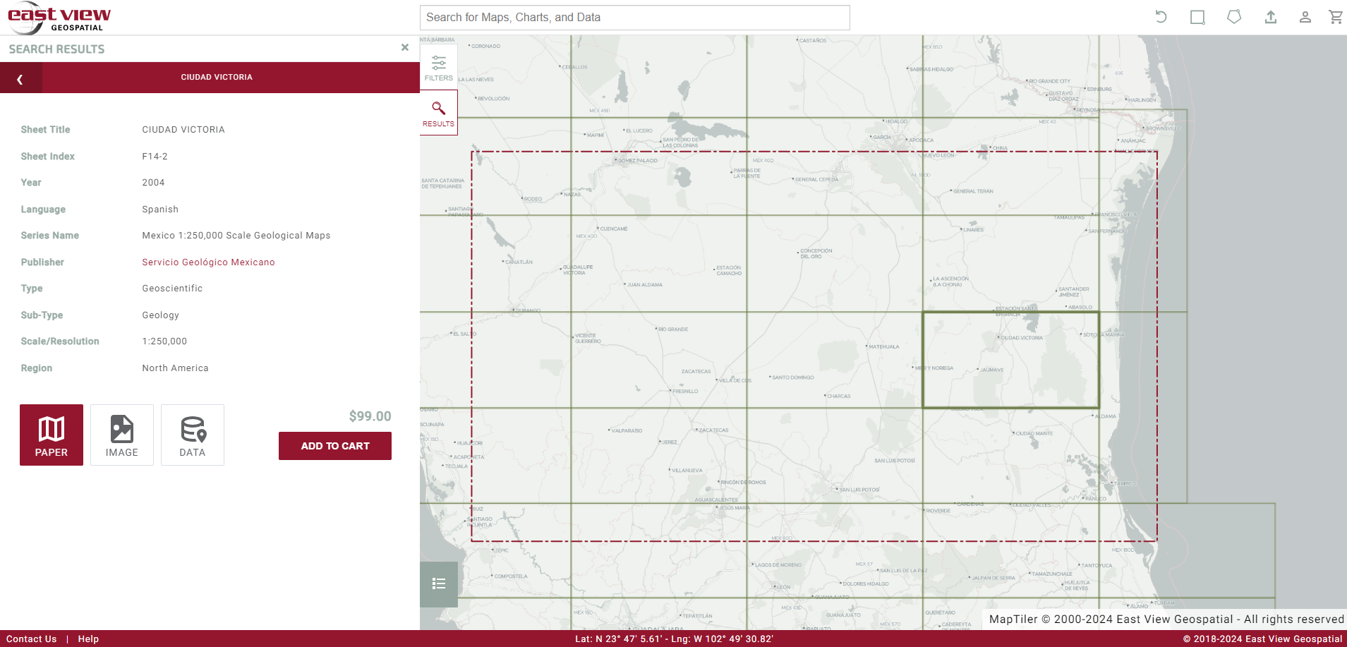
Making a Series Selection:
Selecting a series will deliver a list of sheet results. Individual map sheets can be selected from the list or from the map to view available metadata. Sheets can be selected for purchase from the individual sheet view or from the list of results.
Depending on availability, paper, image, or data formats of a map sheet can be selected for purchase by adding them to the cart. In some instances prices are not posted, in which case users can still add the item to the cart and it will submit a request to East View for pricing and availability. Note that multiple sheets can be added to the cart at once from the list of results in map search mode.