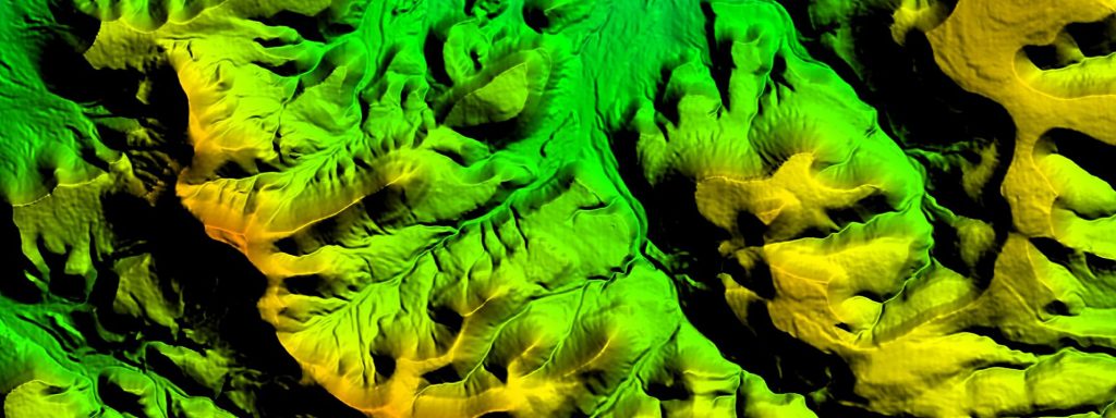
(This is an example of a Digital Elevation Model, made in-house at East View Geospatial.)
At East View Geospatial, much of the work we do is project-based and involves helping our clients better understand the physical terrains of their areas of interest (AOIs).
Digital Elevation Models, or DEMs, are frequently vital data inputs in that process. We asked our Senior Account Manager, Jerod Fink, to break down what DEMs are and to go over how we utilize them here at EVG.
“A Digital Elevation Model (or DEM) is a 3D representation of a terrain surface. DEM data is displayed as a grid, usually represented in meters. This data utilizes an elevation or Z value at the center point of the grid cell to indicate height above or below sea level (in bathymetry data), or an ellipsoid. Grid cells can vary from 1km square to less than a meter square. The lower the grid spacing, the higher resolution, and thus more accurate and detailed a dataset becomes. High-resolution DEMs have many uses across all different industries, especially for different types of planning.
DEM is an overarching term for elevation data which can be further defined into two types: Digital Terrain Models (DTM) and Digital Surface Models (DSM). DTM heights represent bare-earth terrain. With corrected hydrographic features, rivers flow downhill, and the user can get a very accurate representation of all-natural terrain features.
Digital Surface Models (DSM) incorporate the built-up environment above the terrain in their values. For example, buildings, bridges, tree canopy and other vegetation heights.
DSMs are used widely in pipeline planning, mobile network development, and population movement studies. DSMs are of particular use to the airline industry (both civilian and military) for obstacles and terrain avoidance systems.
DTMs, on the other hand, are used widely in the planning of smaller areas where terrain details are of utmost importance. A few of the specific areas where DTMs are widely used are road development, ski resort construction, oil and gas pad construction/maintenance, and particularly flood mitigation.
Accuracy in planning is key- businesses need extremely detailed and specific data to ensure that time and resources are utilized in the most efficient way.”
At EVG, we provide both off-the-shelf elevation data as well as produce custom elevation models in-house so they can be tailored to our clients’ exact specifications. We are your GeoConsultant and will work with you to find the right product or solution to meets your needs. Contact us to see how we can work with you today!


