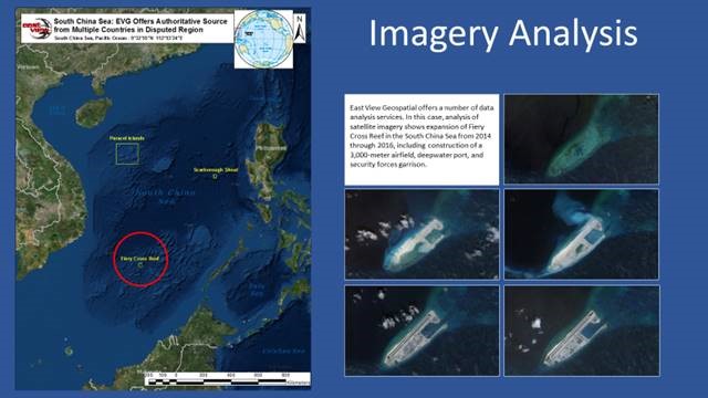
Geospatial data has many applications. With the continued advancement of technology, geospatial data has been used increasingly in defense and intelligence communities. This information can make or break key decision-making within the intelligence community. For example, Remote sensing technology allows for tracking activity that may have not been disclosed publicly while at great distances. We talked to East View Geospatial Sales & Marketing Director, Jonathan Thompson, about what GEOINT is and why it’s so important.
“The US Government defines GeoINT or Geospatial Intelligence, as the exploitation and analysis of imagery and geospatial information to describe, assess, and visually depict physical features and geographically referenced activities on the earth.
GEOINT is made up of three key elements: geospatial information, imagery, and imagery intelligence.
EVG regularly sources, produces, and supplies geospatial information, including topographic and scientific mapping, human geography datasets, local geonames, and transportation networks to name a few. These are key geospatial information inputs in the intelligence process.
Moreover, EVG engages in imagery intelligence and imagery interpretation. Whether it be satellite-borne, airborne, electromagnetic, radar, or synthetic, we provide and analyze all types, formats, and resolutions of remotely sensed data for imagery intelligence and analysis. “
The evolution of geospatial information has equipped defense and intelligence agencies with the ultimate decision-making tools. By utilizing readily available data and performing deep analysis & interpretation on an ever-growing amount of remotely sensed data, the intelligence community can better evaluate opportunities, and threats. As the world continues to change and countries all over the world are trying to position themselves for the best future, geospatial intelligence will be a crucial element in their long-term success.

Jonathan Thompson, Director of Sales & Marketing


