With a route finalized and data inputs identified, it was time to decide precisely what kind of maps the Eco-Challenge production team required. The need for three distinct types of maps emerged – a very large wall map for production headquarters, a smaller-scale overview map for staff, and a set of competitor maps. All told, to fully meet the Eco-Challenge team’s diverse needs, East View Geospatial produced 11 custom maps and printed a total of 991 maps in-house.
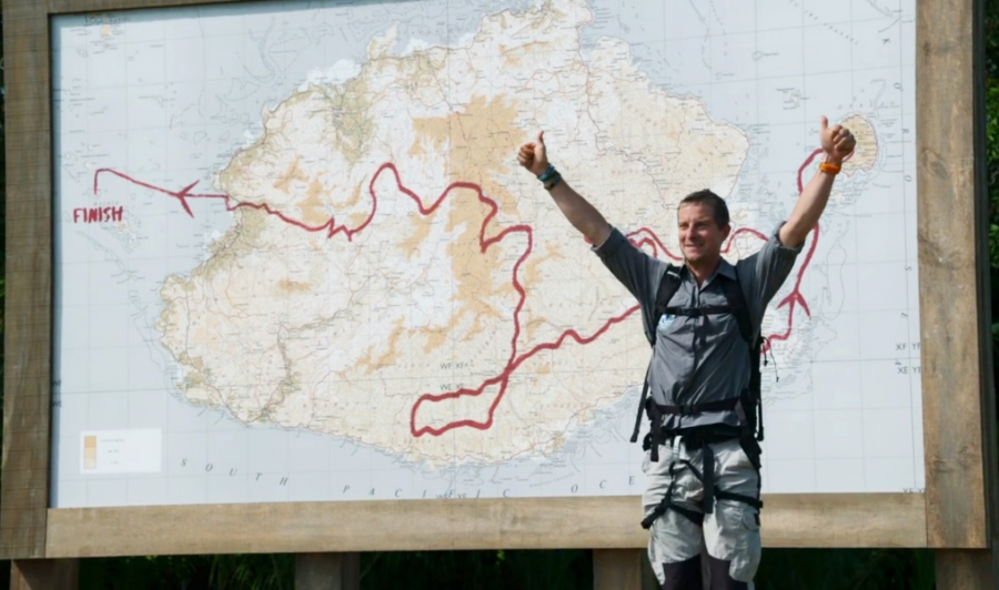
Perhaps the most recognizable of these maps, to viewers, is the large dry-erase wall map at 1:50,000 scale, housed in production headquarters. This map provides a comprehensive, detailed representation of both the area of competition and ideal routes through it, complete with topography and bathymetry. The map can be seen almost immediately in the first episode as the host, Bear Grylls, unveils the large map and welcomes competitors. The ability to make notations in dry-erase marker is a feature that ties the strength of physical maps with something closer to a modifiable GIS. Its scale also helps impress upon viewers the scope of the race. To create this map, we utilized in-house GeoMosaicing expertise, stitching data together from 20 existing 50K maps over Fiji and custom made hydrographic charts.

Host Bear Grylls unveils the course map as he welcomes the competitors. Image courtesy of Amazon.
For in-the-field staff, we developed a 1:250,000 scale course overview map. This map contains information not available to the competitors, like most efficient routes, transportation methods, and emergency points of interest. This information proved crucial as the production crew were up against the same natural hazards as their subjects, as detailed in the LA Times.
Finally, each team of adventure athlete competitors received a set of 9 custom maps and nautical charts. These maps consisted of mostly raw 50K data, organized by day and leg of the race. These maps are visible in the hands of teams as they break for navigation, or around their necks in clear bags as they progress through the race. Their misreading of these maps is also apparent from time to time, illustrating the limits and advantages of physical maps and the skills necessary to utilize them.


