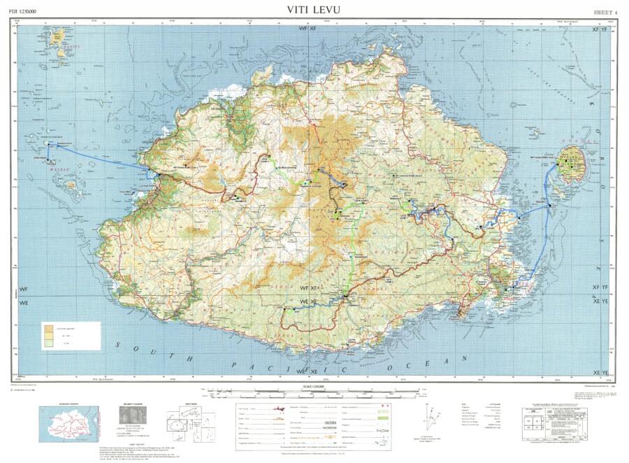
The EVG-made custom map of Fiji that contains elevation data, 50K and 250K topographic information, and bathymetric data.
A few months after East View Geospatial supplied mapping to the Eco-Challenge production team, their proposed route was given the go-ahead. With a clearly defined area of interest, the conversation turned to data inputs, and East View Geospatial’s well-honed GeoConsulting abilities took center stage.
When EVG does consulting for its clients, the goal is two-fold. We want clients to know the full extent of their options, and we want to leave them better educated than before our engagement.
Eco-Challenge needed custom maps created for competitors and production personnel. As these maps differ in purpose, the necessary data was far-ranging. Knowing what ‘ingredients’ to combine to build certain kinds of maps is knowledge gained from decades of experience; anticipating other information is another hallmark of that expertise.
When the team mentioned their desire to create a web app to track competitors’ movements in real time, for example, we leaned on our unparalleled collection and supply network to procure remotely sensed data including satellite imagery and terrain data. Without this information, 3-D visualization would not be possible. More information on this portion of the project will come in future blogs.
In the end, we provided national topographic maps at 50K and 250K scale, bathymetric data derived from nautical charts (essentially sea-floor terrain), multi-resolution satellite imagery, and elevation data.
The production team finalized the routes during this phase, and we moved on to determining the precise kinds and number of maps needed for the production team and competitors.


