In previous posts, we’ve covered how governments utilize GIS and diverse spatial data to respond to crises and plan for future ones. In nations with electoral systems like the United States, people who want ‘in’ to the government utilize much of that same information to run their campaigns and spur voter turnout.
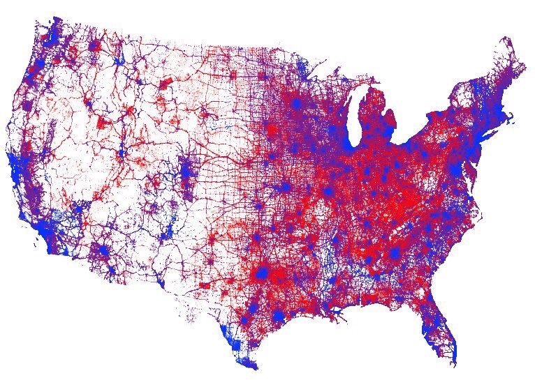
A visual representation of every vote cast in the 2016 United States presidential election. Image courtesy of Kenneth Field and Esri.
Since the early 2000s, (or at least as far back as 2004) political campaigns have added ‘microtargeting’ to their tool kits – essentially turning direct marketing methods into outreach tools for campaigns.
In this post from 2008, Karsten Vennemann of Terra GIS describes his experience working for the Obama campaign. Back then, he made use of open-source technology to identify and target specific voters. Put simply, the process allowed the campaign to lay voter data over base layers like precinct and county boundaries. The approach was so well liked, according to Vennemann, it was implemented in roughly a dozen highly contested states.
Today, tools like those offered by Esri’s ArcGIS have streamlined that process of turning addresses into useable data points. The first step is turning a list of addresses into a ‘geocoded’ list of voters. To do this, tools like Esri’s Tapestry Segmentation will analyze neighborhoods by socioeconomic and demographic factors. The program then classifies neighborhoods using 67 categories of market segments based on information like income, hobbies, education, and religious affiliation. Combine the Tapestry information with a list of addresses, and a picture of potential voters and donors emerges.
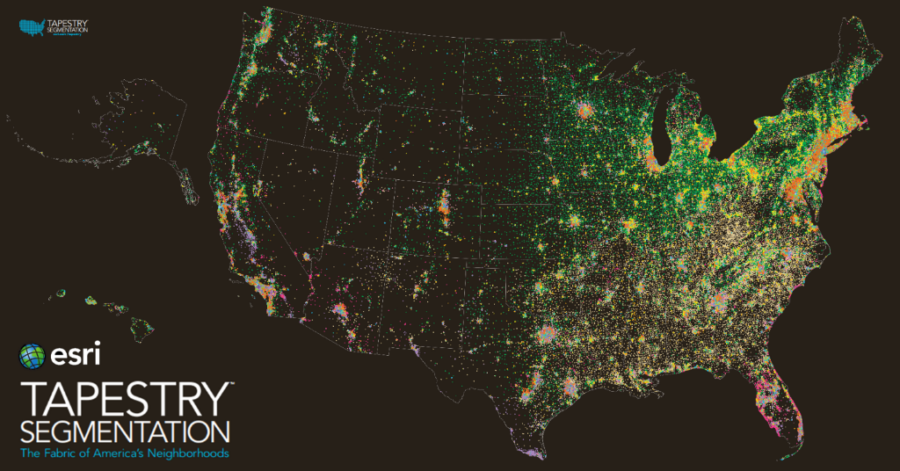
Esri Tapestry information of potential donors & voters. Image courtesy of Esri.
When that data is combined with information about boundaries and districts, campaigns can begin formulating ground plans. They can focus their attention on areas with potential support, while also avoiding areas where their cause may be hopeless. Essentially, this eliminates figuring out where to door-knock the hard way.
In today’s world of online data, evolving voter habits, and other factors, the ways in which this approach can be applied will likely continue to evolve. In next week’s post, we’ll take a look at how governments can use these same tools to ensure fair, accurate elections.


