As SAR data becomes more affordable and accessible, the geospatial industry will adapt with it. Just how precisely SAR’s impact will be felt remains a big question mark at this stage. Nonetheless, the excitement is palpable. Still, plenty of new technology gets hype and fades away; what makes new tech become standard tech is its ability to replace what came before it.
SAR has that ability, considering its edge over optical imagery with regard to weather factors and nighttime imaging capabilities.
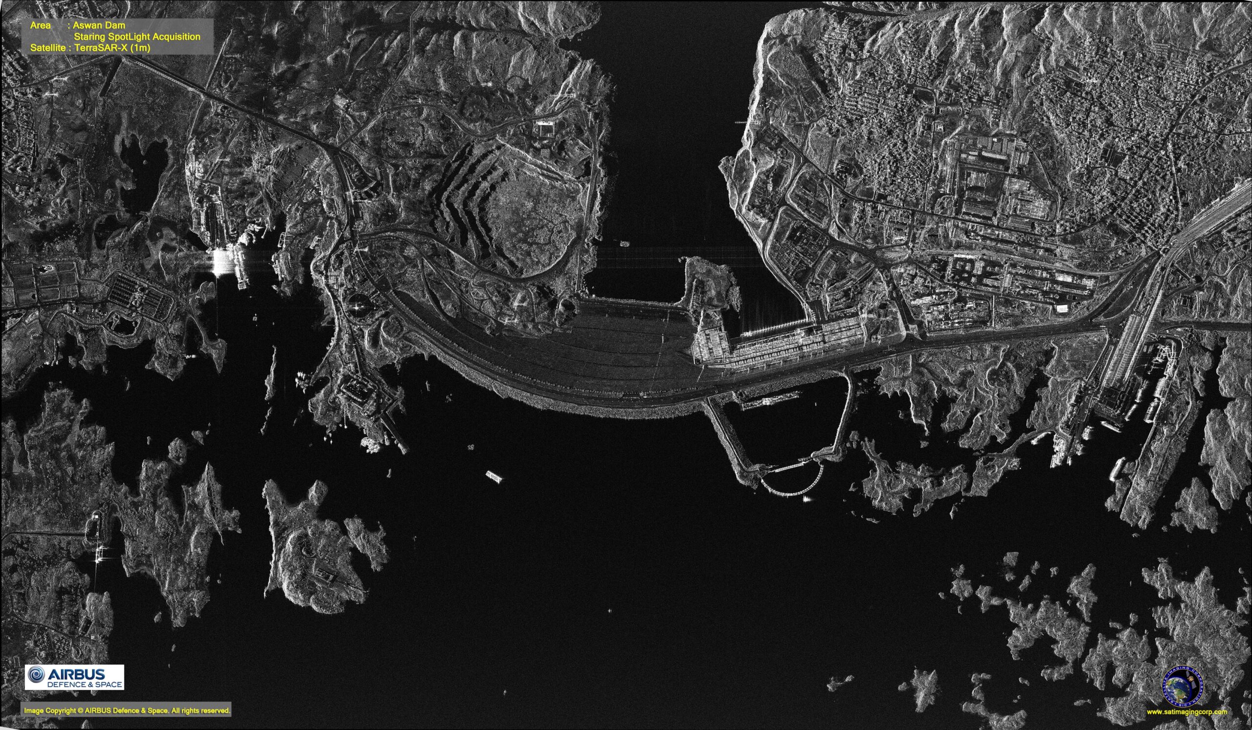
SAR image of the Aswan Dam in Egypt. Image courtesy of Satellite Imaging Corp. and Airbus Defence & Space.
For years, SAR technology and data was mostly in the domain of governments. Its capabilities and usefulness have been well-proven, but principally for entities with enormous resources at their disposal. For example, imagery analysts from National Geospatial-Intelligence Agency (NGA) design workflows to regularly ingest SAR and make it useful. But that is only beginning now in the private sector.
Thanks to companies like Capella Space, which is continuing to launch its own constellation of SAR microsatellites, the technology is starting to creep out from behind government curtains.
East View Geospatial is an early reseller in North America for Capella Space, which now has the highest resolution commercial SAR imagery in the world. Four months ago, Capella launched its first operational satellite, Capella-2, a 107kg microsatellite that enters space the size of a washing machine before transforming in orbit. Data from that satellite is capable of producing 50 cm x 50 cm radar images – a level of detail that, when coupled with worldwide tasking capacity, unlocks even more potential and opportunities.
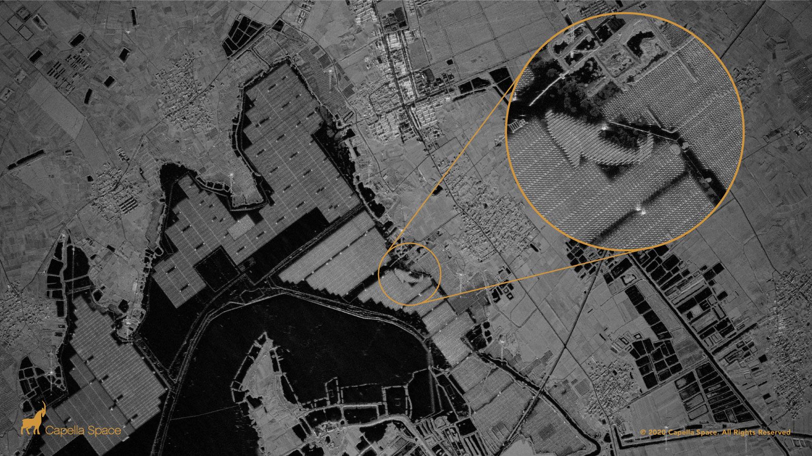
A SAR image of Tiangang Lake Solar Farm in China. Image courtesy of Capella Space.
The most obvious opportunity is nighttime imaging. Current commercial satellites are designed with sun synchronous orbits that generally image during peak sunlight hours – 10:00 a.m. or 1:00 p.m. This leaves tracking of nocturnal changes and information difficult to procure. With SAR satellites dotting the sky, capabilities for nighttime research and data collection, we believe, will blossom.
The shift will not occur overnight, however. Most industry professionals are trained in optical imagery and will have to learn to use SAR and the analytical tools associated. As companies like Capella launch more and more satellites, though, we predict an explosion of research and development around SAR data and analytics. This will eventually lead to academics crafting new theories and testing new applications, and on the commercial side, companies developing new and innovative tools for big data and SAR-focused algorithms.


